- Home |
- Why With Us |
- About Us |
- Booking |
- Contact Us |
- Site Map
- Home
-
Nepal
-
Trekking
- Arun Valley with Gokyo Lakes
- Everest Base Camp Trek
- Everest- A Living Culture Exploration
- Everest Explore
- Everest Base Camp (via Thame) Trek
- Everest Base Camp with Kala Patthar
- Everest Comfort Trek
- Everest High Passes with Ama Dablam Base Camp
- Everest Mani Rimdu Festival Trek
- Everest Nagpa La Trek
- Everest with three high passes
- Gokyo Ri, Chola Pass & Chukung Ri with Kala Patthar
- Gokyo with Everest Base Camp
- Jomsom - Muktinath
- Jomsom - Muktinath
- Khayar Lake Trek
- Manaslu and Tsum Valley with Larkya La
- Upper Mustang Trek
- Manaslu High Circuit
- Manaslu, Tilicho Pass & Upper Mustang
- Annapurna Base Camp Trek
- The Annapurna Circuit Trek
- Annapurna Panorama
- Nar and Phu Valley Trekking
- Nepal Rhododendron Trek
- Royal Trek
- Saribung Trek and Expedition
- Annapurna Sanctuary Trek
- The Annapurna Sunrise Trek
- Expedition
-
Rafting
-
Peak Climbing
-
Tours
- Kathmandu-Chitwan-Jungle Tour with visit to Pokhara
- Dawn to Dusk Tour
- Historical, Natural & Cultural Tour with Camping
- Kathmandu Valley Temple Tour
- Temple - Panorama - Jungle Tour
- Taste of Nepal
- Central Nepal Tour
- Explore Nepal Tour & Trek
- Nepal Cross-country Tour
- Best of Nepal Tour & Treks
- Kathmandu valley rim Tour & Treks
- Nepal Culture Tour
- Introduction to Nepal Tour & Treks
- Nepal at a glance Tour & Treks
- Wonders of Nepal Tour & Treks
- Glimpses of Nepal Tour & Treks
- Through the Silhouette Tour & Treks
- Tent and Temple Tour
- Kathmandu-Chitwan-Pokhara Tour
- Historical, Cultural City and Jungle Tour
- Nepal Wildlife Tour
- Nepal Panorama Historical Tour
- Nepal Adventure Tour
- Nepal Pilgrimage Tour
- Ghalegaun-Ghanapokhara Homestay Tour
- Jungle Safari
- Adventure Sports
-
Trekking
- Tibet
-
Bhutan
-
India
- Yoga Tour
- About Us
-
The Great Himalayan Trail
-
Short Tours/Treks


Gaurishankar Conservation Area
A covers an area of 2,179 square kilometers and encompasses 22 Village Development Committees of 3 districts (Alampu, Bigu, 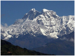 Bulung, Chankhu, Chilankha, Gaurishankar, Kalinchok, Khare, Laduk, Lamabagar, Marbu, Orang, Suri and Syama VDCs of Dolakha district; Fulpingkatti, Ghorthali, Gumba, Listikot, Marming and Tatopani VDCs of Sindhupalchok district; Chuchure and Gumdel VDCs of Ramechhap district). 2001 census reveals a population of 56,364 people in 11,582 households. Tamang is the largest ethnic group accounting for 25.84 % of the total population followed by Sherpa with 22.42 %, and Chhetri 18.36 %. Other ethnic groups are: Newar, Thangmi, Gurung, Brahman, Jirel, Kami, Damai and Sarki.
GCA comprises following 16 major vegetation types: Pinus roxburghii forest, Schima-Castanopsis forest, Alnus forest, Pinus wallichiana forest, Pinus patula forest, Rhododendron forest, Quercus lanata forest, Lower temperate oak forest (Quercus semicarpifolia forest), Lower temperate mixed broad leaved forest, Abies forest, Upper temperate mixed forest (Birch-rhododendron forest), Temperate mountain oak forest, East Himalayan Oak forest, Juniperus forest, Shrubland (Rhododendron anthopogon bushes) and Moist alpine scrubs. Confirmed observations of faunal diversity inside GCA totals to 34 species of mammals, 16 species of fishes, 10 species of amphibians, 8 species of lizards, 14 species of snakes, 235 species of birds.
The region is quite rich in water resources and is catchment of Khimti, Bhotekoshi, Sunkoshi, and Tamakoshi rivers which are source of water for some major hydro-power projects in the country. The region is also famous for glacial lakes, particularly the Tso Rolpa which came into limelight with the possibility of its bursting. Glaciers account for 2.77% of the total area of the region. With the issue of climate change becoming prominent in the national and international arena, the region carries special significance.

National Parks

Wildlife Reserve
Trekking in Nepal
Expeditions In Nepal
Rafting in Nepal
Tours in Nepal
Some of the world's best known organizations, famous writers and travel magazines recommend us
![]()
![]()
![]()
![]()
![]()
![]()
All rights reserved.