- Home |
- Why With Us |
- About Us |
- Booking |
- Contact Us |
- Site Map


Fungling - Tumglingtar Trek
Days from
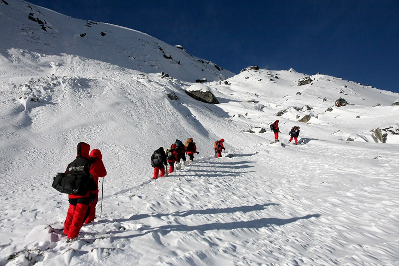
This trek traverses through two of the most beautiful eastern districts of Nepal namely Taplejung and Sankhuwasava. Just recently researched under the initiatives of Trekking Agencies Association of Nepal (TAAN) as part of its ongoing exploration trips for finding new and virgin trekking trails in Nepal, the trip offers visitors a truly unique opportunity to experiencing Nepal’s eastern most attractions at their best.
| Max. Elevation : 4713m | Duration : 25 days |
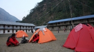
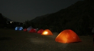
| Type of trek : Camping | Starting point : Fungling |
| Ending point : Tumglingtar | Best Season : Spring and autumn |
| Grade : Moderate-Strenuous | : |
This trek traverses through two of the most beautiful eastern districts of Nepal namely Taplejung and Sankhuwasava. Just recently researched under the initiatives of Trekking Agencies Association of Nepal (TAAN) as part of its ongoing exploration trips for finding new and virgin trekking trails in Nepal, the trip offers visitors a truly unique opportunity to experiencing Nepal’s eastern most attractions at their best.
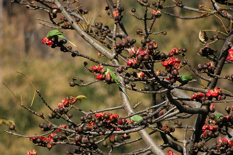
The trek starts from Fungling of Taplejung district bordering India in the east and China in the north. Famous for its proximity to Mt. Kanchenjunga (8586m), the third highest mountain in the world, Taplejung is well connected both by road and air to the rest of the country. The area is one of the most beautiful regions of Nepal with spectacular landscape, Himalayan peaks above 7000meters and a wide variety of flora and Fauna. Alpine grassland, rocky out crops, dense temperate and subtropical forests and low river valleys make up the region. Taplejung has an extreme altitude variation ranging from 670m to 8586m from the sea level.
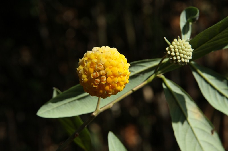
From eleventh day of the trek, the route leads to Sankhuwasava district offering a range of exploration opportunities. Some of the highlights of this district include the world’s fifth highest mountain Mt. Makalu- 8481 m (27825 ft), the lowest valley of the world (the Arun Valley) and the famous Makalu Barun National Park which was established in the year 1992 as an eastern extension of the Sagarmatha National Park and is the world’s only protected area with an elevation gaining more than 8,000 m (26,000 ft) and enclosing tropical forest as well as snow-capped peaks. The park exhibits a high diversity of forest types that are characteristic for the Eastern Himalayas, ranging from near-tropical dipterocarp monsoon forest on 400 m (1,300 ft) altitude to subalpine conifer stands on 4,000 m (13,000 ft) altitude. The park is home to a wide diversity of faunal species. There are 315 species of butterflies, 43 species of reptile and 16 species of amphibians. 78 species of fish inhabit the many ponds, lakes and rivers. Ornithologists have recorded 440 bird species, ranging from eagles and other raptors to white-necked storks and brilliantly colored sunbirds.
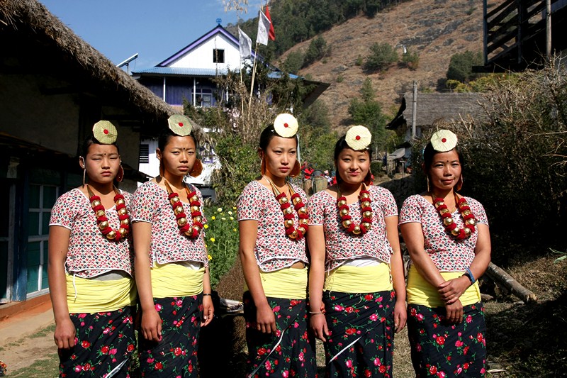
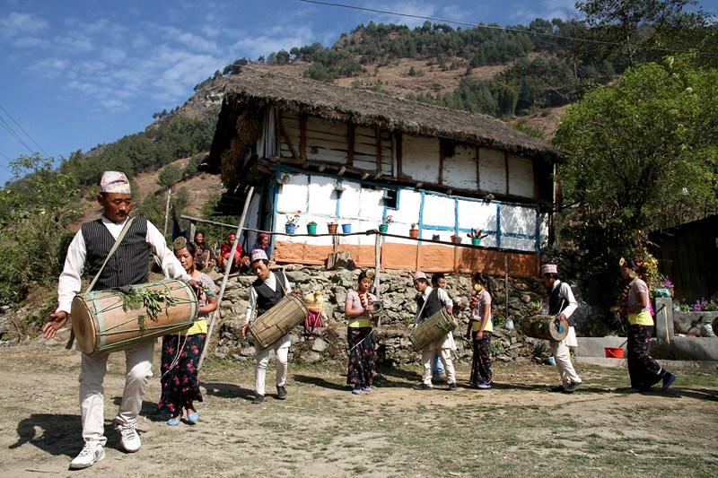
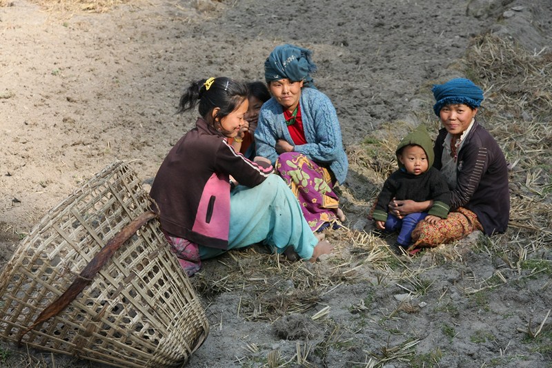
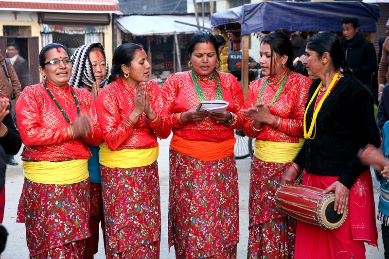
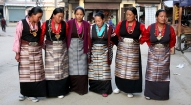
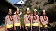
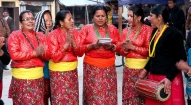
This trek offers some of the most spectacular views of the Himalaya landscapes. Thirteen of the world’s highest mountain peaks rising above 7000m including Mt. Kanchenjunga can be observed during this trip. The trekking route encompasses the treasure of the mountains, the longest blue glacier in the world – the Yalung as well as a wide range of bio diversity. The trekking route is also home to a diverse range of ethnic groups like the Limbus, Tibetans, Sherpas, Rai, Gurung, Magars and Tamangs.
Day 01: Kathmandu Arrival, transfer to hotel.
Day 02: Kathmandu sightseeing, welcome dinner in the evening hosted by Makalu Adventure with live Nepalese culture show.
Day 03: Kathmandu – Bhadrapur (by plane) and drive to Ilam (3 hrs), overnight at Illam.
Day 04: Illam – Fugling (Taplejung) 1777m, overnight at Fugling.
Day 05: Fugling - mitlung (909m), 5 hours
Day 06: Mitlung (909m) – chhiruwa (1246m), 6 hours
Day 07: Chhiruwa (1246m) – Lelep (1687m), 6 hours
Day 08: Lelep (1687m) – Ila Danda (2051m), 5 hours
Day 09: Ila Danda (2051m) - Selep (2525m), 5 hours
Day 10: Selep- Olangchung gola (3208m), 5 hours
Day 11: Olangchung gola- Langmale (3993m), 5 hours
Day 12: Langmale– Pass camp (4713m), 6 hours
Day 13: Pass camp - Yak kaharkha (4595m), 5 hours
Day 14: Yak kharkha - Thudam (3571m), 3 hours
Day 15: Thudam (3571m) –Kharkha (2877m), 6 hours
Day 16: kharkha– Chantam (2229m)
Day 17: Chantam– Hatiya (1585m), 7 hours
Day 18: Hatiya – Gola (1128m), 5 hours
Day 19: Gola– Hedangna gadi (1179m), 5 hours
Day 20: Hedangna gadi – Chichila (1889m),
Day 21: Chichila– Khadbari (1022m)
Day 22: Khadbari – Tumlintar (396m)
Day 23: Tumlintar – Kathmandu (by plane)
Day 24: Kathmandu at leisure, farewell dinner in the evening
Day 25: Final departure
Detailed Itinerary:
Day 01: Arrive Kathmandu International Airport, (1300m/4264ft) and transfer to hotel.
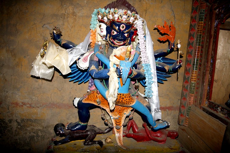
Day 02: After breakfast we set out for an extensive guided sightseeing tour of Kathmandu valley’s cultural, historical, religious and world heritage sites. During the course, we visit the famous Pashupatinath temple of Lord Shiva situated at the holy bank of River Bagmati where we will also observe the Hindu cremation ritual. We then proceed to the Boudhanath stupa, a major pilgrimage centre for the Buddhist faith which also is the largest of its kind in the world. We then have a short break for lunch followed by a visit to Swoyambhunath stupa also known as the Monkey Temple from where we can have a bird’s eye view of whole of Kathmandu valley. Following this we then proceed for a visit to Kathmandu Durbar Square, the oldest royal palace of Kathmandu and a UNESCO world heritage site. The whole are of Kathmandu Durbar Square is dotted with numerous fascinating Nepalese architect dating back many centuries. The site is also the home of Nepal’s living Goddess – Kumari, where we will evening we will attend the welcome dinner hosted by Makalu Adventure with live Nepalese culture shows.also have the opportunity to experience firsthand this unique Nepali tradition. In the
Day 03: Kathmandu – Bhadrapur (by plane) and drive to Ilam (3 hrs), overnight at Illam.
Day 04: Illam – Fugling (Taplejung) 1777m, overnight at Fugling.
Day 05: Fugling - mitlung (909m), 5 hours
Today is actually the first day of our trekking which starts from Fugling, headquarter of Taplejung district. Sherpa tole also known as Zero point serves the gateway to the trip. Today’s journey is followed by dense green leaves of cardamom on down side along with Alnus trees (Uttis) on the uphill side till Hangdewa VDC which takes around 2 and half hour. Along the trail there are plenty of small tea shops in places like Asangpati Tole, Gaigode Tole and Panisar Tole which could serve as an alternative for homestay in the very near future when basic infrastructures such as toilets and dining halls are upgraded to higher standard. From Panisar the trek leads to downhill at around 35 degree till 35 minutes to the suspension bridge. This ends the border of Hangdewa VDC and leadsa to Furumbu VDC. After crossing suspension bridge, a 10 minute walk brings us to lunch place with a total of 3 and half hours walk from Fungling at Pawa village. The trek from lunch place frequently runs up and down leading to Tamor River at Mitlung which takes around 2 hours. Mitlung is the first day camp site with a excellent camping site with facilities for water, kitchen and dining hall. The camping site is on the bank of Tamor River with panoramic view of green forest and flowing river.
Day 06: Mitlung (909m) – chhiruwa (1246m), 6 hours
The second day trek starts with a walk through the bank of Tamor River until Furumbu which takes around 40 minutes of walk. From Furumbu a half hour walk uphill leads to a arrest place (Chautara). Then the trek gradually runs down through Ulnus and Schima wallachiana mixed type forest leading to lunch place at Siwa Bazar at Linkhim VDC after a total walk of 3 hours. The lunch place has a small market and other facilities including pharmacy, police post, and some groceries. From here on the trek runs through the bank of Tamor River leading to Tawa village reached after crossing the river. Tawa village has a small tea shop and the trek runs uphill fromt his point till KCAP entrance gate at Thiwa Village with a total of 2 and half hour’s walk. From the entrance gate the trek gradually runs down and leads to camping site at Chiruwa after crossing a suspension bridge wia a walk of 40 minutes. Chiruwa has a small market with couple of lodges which is usually used by local commuters.
Day 07: Chhiruwa (1246m) – Lelep (1687m), 6 hours:
The third day trek starts from Chiruwa and gradually runs through the bank of virgin Tamor River. All along the way the scenery is dramatic with green Ulnus trees before arriving to a rather bizarre and huge landslide. Trekkers should pay extra care during the crossing of this landslide just in case. After crossing the landslide and following a walk of 3 hours we then arrive to Tapethok which serves as today’s lunch site. Tapethok is a beautiful plas with beautiful cardamom garden where there is also a tourist check point of KCAP along with small markets and tea shops. From Tapethok, the trek runs along the bank Tamor River leading to Pembu from where the trek climbs uphill for nearly 3 hours till Lelep, the next camping site.Lelep is the head quarter of KCAP with hotels, groceries, police post, teashops and excellent campsite.
Day 08: Lelep (1687m) – Ila Danda (2051m), 5 hours
The fourth day’s trek runs through the bank of Tamor River with dense forest and the opportunity for spotting some wildlife. For the most part the trek is accompanied by dense broad leaved and pine mixed forest until arriving to a monastery and leading to the lunch place at Gowatar. After lunch we continue our walk arriving to two beautiful falls falling from about 100m. From here a walk of an hour leads us to a suspension bridge at the meeting point of Phedi and Tamor River from where the trek runs uphill till Ela Danda which serves as today campsite. From Ela Danda, there are superb views of snowy peaks including Small Kasturi peak and beautifully flowing Tamor River.
Day 09: Ila Danda (2051m) - Selep (2525m), 5 hours
Today the trek runs straight and level falt for an hour leading to a rest place (Chautaro) from where a walk of 3o minutes takes us uphill through Ulnus and hododendron foest for an hour leading to a suspension bridge. After crossing the bridge the trek runs gradually up the famous red panda habitat at KCA before arriving to Maguwa for lunch from where we will have an hours’ walk before arriving to our campsite at Selep Kharka.
Day 10: Selep- Olangchung gola (3208m), 5 hours
The sixth day trek is more exciting as it runs through the bank of Tamor River and leading to Jongim, a flat land surrounded y snow capped hills. Further we walk through the dense Rhododendron forest and arrive to Ramite for lunch with stunning views around. A walk of 45 minutes from here will take us to our camp site at Olangchung Gola. He village of Olangchu Gola has some 50 houses, a 465 year old monastery wit gold written manuscript, KCAP office, health post, border police post and a primary school
Day 11: Olangchung gola- Langmale (3993m), 5 hours
The seventh day trek will take us what is called the ‘no man’s land’ and will continue to feature this till we arrive at Thudam. The walk from Olangchung gola is very scenic with snowy mountains and bank of Tamor River consistently accompanying us. It is often recommended that we take at least one or two local Sherpa to guide us through to our destination as the trails from here onwards are not very well marked. However, on a closer inception, there revels to be series of stone piles indicating the direction needed to follow towards Langmale. Walking through thick Pine and Rhododendron forest we finally arrive to Jadak – today’s lunch place from where it is a 3 hours walk to our campsite at Upper Langmale.
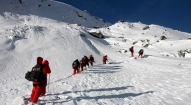
Day 12: Langmale– Pass camp (4713m), 6 hours
Today we have the opportunity of experiencing some snow leopard footprints during the trek, which runs along the bank of Tamor. On the other side of Tamor there is dense rhododendron forest. A walk of 3 hours lead us to the lunch site at Tangchetar from where it is another 3 hours before arriving to our campsite at Pass camp, 4713m.
Day 13: Pass camp - Yak kaharkha (4595m), 5 hours
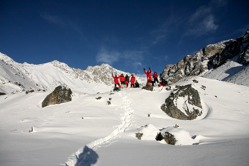
Today is going to be the most adventurous day as it involves the crossing of Lumba Sumba Peak (5200m.) We start today’s walk as early as possible in order to avoid the mid day scorching sun while crossing the pass. Today we need to ensure that every one is carrying enough water along with packed lunch. After about 4 hour’s adventurous crossing, we then arrive to Yak (or Chaunri) Kharka for our campsite.
Day 14: Yak kharkha - Thudam (3571m), 3 hours
The tenth day trek leads us gradually to lower elevation. From Yak kharkha, a walk of 3 hours will bring us to the lunch place at the cross section of way to Lyasha (a place in Tibet). After lunch we continue or journey to Thudam where our campsite is set up. Thudam is a small village comprising of some 40 Sherpa houses along the beautiful river bank.
Day 15: Thudam (3571m) –Kharkha (2877m), 6 hours
Today’s trek runs through the bank of Chujung Khola with panoramic views of Mt. Makalu and its range with almost unending greenery to walk through. On the trail we could also spot red pandas. Today we should have packed lunch and plenty of water along with us before starting the journey. It takes about 6 hours to reach today’s campsite at Kharka.
Day 16: Kharkha– Chantam (2229m)
Today the trek runs through dense rhododendron forest and there are no settlements coming along the way during our walk, for a long time. There are usually a number of small paths crossing over and confusion could easily arise as to which one to take. It might therefore be a good idea to hire a local Sherpa for a day or two for this section of the crossing. After 3 hour’s walk, we will reach to the lunch site at Chaurikharka from where there are superb views of Chyamtang, Arun River, Ridha village and the way leading to Kimanthanka. From the lunch spot we will need to walk for 3 hours on a steep loped path to reach Arun River where a suspension bridge is found. And after crossing the bridge, we need to climb up for an hour to reach camping site at Chyamthang, which is a small but beautiful village. Most of the houses hare are made up of stones and the majority of residents are the Sherpa people.
Day 17: Chantam– Hatiya (1585m), 7 hours
From Chantam, it will take us some 3 hours arriving today’s lunch place at Gimber village. The trail is well marked and lots of birds can also be sighted along. Passing through dense rhododendron forest with views of Arun River flowing, we arrive to Gimber for lunch. Gimber village is located in a very nice spot from where there are good views of Makalu range. After lunch we continue our trek to Hatiya where our campsite is set up for today. Hatiya is the entry point of Makalu National Park with mostly Bhote people residing.
Day 18: Hatiya – Gola (1128m), 5 hours
Today, the trek runs through the bank of Arun River till the camping site at Gola. There are some tea shops and groceries on the way and we stop for lunch at the junction of Arun and Barun Rivers. After lunch we continue our trek to our camping site at Gola. Gola is a small village with only 10-12 houses mostly belonging to the Sherpa, Rai and Tamang people.
Day 19: Gola– Hedangna gadi (1179m), 5 hours
Today, the trail runs for most part, through the paddy fields and arrivers to Pathivara, where the famous Goddess Pathivara Temple is located. This is a small village with tea shops, groceries and lodges inhabited mostly by the Gurung people. We have our lunch here and from now on the place to camping site Gadi runs through level flat fields and takes us three hours to reach there. Gadi is historically famous as a great battle fort between Nepal and Tibet where Nepal defeated and chased the Tibetan away. There are a number of shops as well as a health post, school, police post and a village market in Gadi.
Day 20: Hedangna gadi – Chichila (1889m)
This is actually the last day of our trek, taking us somewhere 3 hours to reach Num from Gadi. From Gola we descend for an hour till the Arun River and another hours ascending to reach Num. From Num we can find vehicle to Khandbari – headquarter of Sankhuwasava. And from Khandbari we can catch buses to Tumlimgtar and fly to Kathmandu. It takes about 5 hours to reach Khandbari from Num and one hour to reach Tumlingtar from Khandbari.
Day 21: Chichila– Khadbari (1022m)
Day 22: Khadbari – Tumlintar (396m)
Day 23: Tumlintar – Kathmandu (by plane)
Day 24: Kathmandu at leisure, farewell dinner in the evening
Day 25: Final departure
- All airport/hotel transfers
- All accommodation in Kathmandu (including breakfast and all taxes).
- Welcome and farewell dinner
- All accommodation and meals during the trek
- Domestic flights (if and where stated on the itinerary)
- Trek leader, assistant trek leader) Sherpa porters including their salary, insurance, equipment, flight, food and lodging
- Down jacket, sleeping bags, Trekking kit bag/duffel bag, trekking map and trekking Poles
- All necessary paper work and permits (National Park permits or entrance fees etc if required)
- A comprehensive medical kit
- All government and local taxes
- Nepal visa fee
- Airport departure tax
- International airfare to and from Kathmandu
- Excess baggage charges
- Lunch and evening meals in Kathmandu and in Pokhara
- Extra night accommodation
- Travel and rescue insurance
- Personal expenses (phone calls, laundry, bar bills, battery recharge, extra porters, bottle or boiled water, showers etc)
- Tips for guides and porters