- Home |
- Why With Us |
- About Us |
- Booking |
- Contact Us |
- Site Map


Inner Dolpo trek
Days from
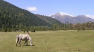
Inner Dolpo has a magical, mythical appeal. The landscapes here are even more desolate than on the Dolpa Circuit and the villages even more isolated and pure. In Inner Dolpo centuries old Buddhist traditions, interwoven with shamanistic influences, are still an important part of daily life. The villages, gompa’s and people you meet during this trek will leave an unforgettable impression on you.
| Max. Elevation : 5375m | Grade : Strenuous |
| Best season : April-October | Type of trek : Camping/Tea house |
| Duration : 21 Days | Starting point : |
| Ending point : | Highlights : Nature |
Highlights of the trek
- Explore the mystique hidden land of Inner Dolpo, with its untouched Tibetan Buddhism and Bonpo culture
- Walk through desolate, stunning landscapes of the Trans Himalayan mountains
- Admire the incomparable beauty of the holy Phoksundo Lake, with its enchanting blue and emerald colors
- Walk the complete famous Demon Trail from the movie Himalaya from Eric Vallie
- Cross three high passes of 5000 meters and above with spectacular views over the snowcapped Himalayas
- Visit the magical Shey Gompa, the spiritual heart of Inner Dolpo
- Sleep in authentic, Buddhist villages and camp in amazing spots amidst the snowcapped mountains
- Chance to see snowleopard, bluesheep, musk deer and monkeys
- Have encounters with villagers, who are direct descendents of the Tibetans
- See Nepal’s highest waterfall, the Phoksundo Waterfall, of 167 meters high
Introduction
Inner Dolpo has a magical, mythical appeal. The landscapes here are even more desolate than on the Dolpa Circuit and the villages even more isolated and pure. In Inner Dolpo centuries old Buddhist traditions, interwoven with shamanistic influences, are still an important part of daily life. The villages, gompa’s and people you meet during this trek will leave an unforgettable impression on you.
Inner Dolpo is a restricted area, for which a fee is charged of US$ 500 for the first 10 days, and US$ 50 for each additional day. Besides, there is a maximum of the number of foreigners that can enter Inner Dolpo each year. Currently this maximum is put at 250 people. This makes a trek into Inner Dolpo a very special and exclusive experience.
The trekking brings you to Shey Gompa, which is often referred to as the spiritual heart of Inner Dolpo. It’s a magical place, situated at the base of Crystal Mountain, which is visited by hundreds of pilgrims each year. They make a kora (circuit) of the Crystal Mountain, Dolpo’s own version of Mount Kailash.
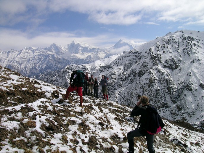
It is a very strenuous hike. You have to cross three high passes, Kang La/ Ngadra La of 5350 m, the Shey La of 5000 m and Jeng La of 5110 m. These crossings involve long climbs and long descend. Besides, you stay above 4000 meters for a long time, with very cold nights. But the unforgettable landscapes, the views from the passes and the contacts with a very special untouched culture make it all worth it.
Leaving from Kathmandu, it’s a 21 days trip, but it can be shorter or longer, depending on the length of your walking days.
There are (basic) guesthouses in Juphal, Dunai, Kageni, Chhepka, close to Sanduwa (next to the Amchi Hospital), Ringmo, Shey, Saldang, Dho and Lingdo. At the other places you have to camp (day 7, 10-14, 16 and 17 of this itinerary).
Dolpa permit information
- Lower Dolpa
The permit fee for Lower Dolpa is US$10 per week. This includes the Dolpa Experience Circuit and Phoksundo Nature Experience Trek.
- Inner Dolpo
Inner Dolpo (or Upper Dolpa) has the same permit structure as Upper Mustang, that is a minimum fee of US$ 500 (equivalent of US$ 50 per day for a minimum of 10 days) and US$ 50 per day thereafter. I’d be happy to say that a percentage of the permit fee goes to the people of Dolpa as has recently been negotiated between the Government of Nepal and Upper Mustang.
Dolpa or Dolpo?
Simply put, Dolpo is a place within Dolpa! Dolpa is the region and Inner Dolpo is the small and remote Shangri-la in the north of the region. Dolpa was first opened to trekkers in 1990 and Inner Dolpo only in 1992.
Day 1: Flight Kathmandu-Nepalgunj
Day 2: Flight Nepalgunj-Juphal (2475 m), walk to Chhepka (2838 m) 6 hrs
Day 3: to Sanduwa/Amchi Hospital (3110 m) 6 hrs
Day 4: to Ringmo/Phoksundo Lake (3733 m) 3 hrs
Day 5: restday Ringmo/Phoksundo Lake (3733 m)
Day 6: Ringmo/Phoksundo Lake (3733 m) to Chunemba (3639 m) 5 hrs
Day 7: to Snowfields Camp (4400 m) 7 hrs
Day 8: to Shey Gompa (4310 m) via Kang La (5375 m) 6 hrs
Day 9: restday Shey Gompa (4310 m)
Day 10: to Namgung (4430 m) via Shey La (5000 m) 6 hrs
Day 11: to Saldang (4060 m) 3 hrs
Day 12: to Sibu (4200 m) 5 hrs
Day 13: to Lagmo Che (4570 m) 4 hrs
Day 14: to Tokyu (4209 m) via Jeng La (5110 m) 7 hrs
Day 15: to Dho Tarap (4080 m) 2 hrs
Day 16: to Sisaul (3750 m) 4 hrs
Day 17: to Laina Odar (3370 m) 7-8 hrs
Day 18: to Lingdo (2391 m) 5 hrs
Day 19: to Dunai (2140 m) 5 hrs
Day 20: to Juphal (2475 m) 3½ hrs
Day 21: Flight Juphal-Nepalgunj-Kathmandu
Below you can find a day-by-day description of this route. Walking times are of course a guideline and differ from person to person. The times mentioned, are excluding breaks.
Day 01: Flight Kathmandu-Nepalgunj.
To get to Dolpa, generally you have to fly to Nepalgunj first. Nepalgunj is a steaming hot city in South Western Nepal, in the lowlands of Terai, close to the Indian border, which is just 8 km away. Culturally the area more resembles India than upland Nepal. Take a cycle rikshaw for a ride in town. You pass the hustle and bustle of the bazaar and see horse carts full of colorful people going to or coming from the Indian border. The Bageshowri temple is one of Nepal’s most important Hindu temples and is worth a visit as well.
Day 2: Flight Nepalgunj-Juphal (2475 m), walk to Chhepka (2838 m) 6 hrs
It’s just a 35 minutes flight to Juphal over steep mountain ridges with beautiful views of snowcapped mountains. Juphal airport is just a gravel airstrip amidst the mountains, which guarantees a spectacular landing. Stepping out of the plane, you enter in a completely different world. From a hot city in the plains, you arrive in a small mountain village, situated in the midst of the Himalaya, breathing in crispy cold air.
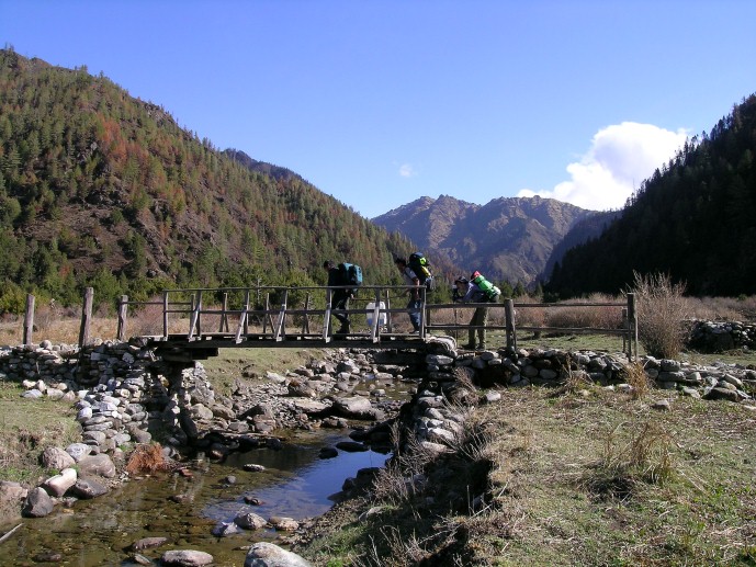
From Juphal you walk down over a small path among fields with wheat and vegetables to the Thuli Bheri River, which you’ll follow after reaching it. A big iron suspension bridge, the Dhim Bridge (99 m long) forms the entrance to the Shey Phoksundo National Park (SPNP). SPNP is Nepal’s largest National Park, established in 1984, with an area of 3,555 km². It aims to conserve the Trans-Himalayan ecosystem and the Tibetan type of flora and fauna. In 1998, an area of 1,349 km² surrounding the park was declared as buffer zone, which is jointly managed by the park and local communities. (You have to pay 1000 NPR entrance fee, except persons from SAARC countries, who pay 100 NPR). Next to the entrance is the small village of Suligat, where you could stop for a tea.
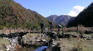
The path follows the Suli Khola River now. Behind you, you can see a part of the Dhaulagiri Range. You pass small villages along the way, like Kageni (2413 m) and Sangta (2520 m), where you could stop for a tea, lunch or stay for the night. In Sangta honey is cultivated. It’s a great place for a tea with honey! While sipping your tea, you can see the bees going in and out the beehives, made from tree trunks. Just before Sangta you enter the forest. It’s a beautiful walk, alongside the wild flowing river, which at some parts is beautiful emerald green. The path is surrounded by pine trees, like spruce, fir, juniper and cypress and passes small bamboo forests and walnut trees. At the other side of the river, the high rocky slope goes up steeply and is dotted with pine trees as well. At the end of the day you reach Chhepka, a small village, surrounded by fields of millet and wheat.
Chhepka has three hotels, La Lee Gurans Hotel and Lodge, Hotel Jharana and Yak Hotel and Lodge. Yak Hotel has a campsite as well.
Day 03: Chhepka (2838 m) to Chunuwar/Amchi Hospital (3110 m) 6 hrs
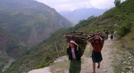
The path goes through beautiful pine forests, with some bushes, birches and other broadleaf trees mixed in as well. It’s following the river all the time and most of it is Nepali flat: sometimes going up and sometimes going down, with a couple of steeper climbs and descents. At some parts the valley gets very narrow and the impressive steep rocks are towering high above you on both sides. On the way you encounter local people with their mules or dzopas (crossbreed between yak and cow) loaded with things to sell. After about four hours you pass the village of Rechi, where there is a camping spot. At the other side of the bridge, there is a small teashop as well.
The path continues at the other side of the bridge. It’s two hours more to Chunuwar. Close to Chunuwar you can find the Amchi Hospital. This is a very interesting place and worth a visit. In fact it is more a clinic, which is well frequented by local people. An Amchi is a doctor who is educated in traditional Tibetan medicine, and always is a lama (monk) as well. Tibetan medicine has a tradition of thousands of years and uses techniques as pulse analysis and urine analysis for diagnosis. For treatment, medicines made of herbs and minerals are used, together with physical therapies, like Tibetan acupuncture. In the Amchi Hospital you can see a collection of herbs and minerals used to cure people. Most Dolpa people prefer to visit the Amchi over a regular doctor when they are ill. A donation is highly welcomed to keep this tradition living.
Next to the Amchi Hospital is a guesthouse with a campsite, Jharana Hotel.
Day 04: Chunuwar/Amchi Hospital (3110 m) to Ringmo/Phoksundo Lake (3733 m) 3 hrs
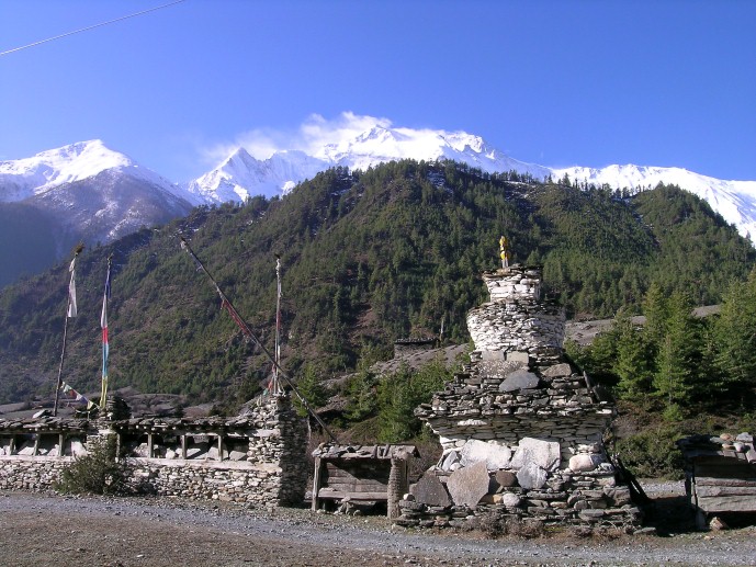
It’s a short hike today to Ringmo and the Phoksundo Lake. It includes a long and sometimes steep climb of about 2 hours. Just before the top, you can see Nepal’s highest waterfall, a spectacular waterfall of 167 meters high, the Phoksundo Waterfall (also called Suligad Waterfall). From the pass you have your first view of the Phoksundo Lake. The path is going down till it gets close to the river, which you follow until you reach Ringmo.
Ringmo is a charming village. People practice the Bonpo religion here. Bonpo is related to Buddhism, but it is a lot older than Buddhism and goes back thousands of years. The religion was founded more than 18,000 years ago by Buddha Tonpa Shenrab Miwo. It is believed that Dolpa used to be the centre of the Bon kingdom, called Zhang Zhung, a big and powerful kingdom in present Western and Northwestern Tibet and surroundings, as in Dolpa you can still find a big concentration of Bonpo practioners. In the 7th Century Zhang Zhung was defeated by the Buddhist kingdom of Tibet, and Bonpo disappeared almost completely. However many Bon traditions were absorbed into Tibetan culture.
Bonpo has more animistic aspects than Buddhism. For outsiders it is difficult to see the difference between Bonpo and Buddhism, but one small but important detail is that you have to cross their shrines, like mani walls (low walls with loose stones with Buddhist mantra’s carved on it) and chortens anti clockwise, while according to Buddhist custom, you pass them clockwise.
The women wear dark or checked dresses with colorful aprons made from yak wool. You see fewer men in the typical dress, which is a long coat, from which they let one sleeve hanging down. Strolling around the village, you might see women weaving. In Ringmo women make very nice woven products, like belts, bags, shawls and blankets. Most items are made from cotton, but they also sell products made from yak wool. There are a few shops where you can buy these. These shops serve as a general shop as well, and you can fill up your stocks of biscuits for the rest of the trek.
Ringmo lies at the shore of the holy Phoksundo Lake. This lake is of a stunning beauty. It has an enchanting deep blue color and is emerald green close to the shore. The water is crystal clear, with no aquatic life in it. Steep cliffs and snowcapped mountains surround the lake. The colors change a bit during the day; you just won’t get enough of simply looking at it. At the shore of the lake, there is a wonderful campsite.
At the other shore, there is a beautiful Bonpo Monastery which you can visit. In the monastery you can observe a statue of Tonpa Shenrab Miwo, the founder of Bonpo religion, who lived thousands of years ago.
Ringmo has a few guesthouses: Sherpa Hotel and Lodge, Trekkers Lodge, Himalaya Hotel, Shey Shikhar Hotel and Shey Phoksundo Hotel. Besides, you can camp at the shores of Phoksundo Lake.
Day 05: Ringmo/Phoksundo Lake (3733 m), free day
It is indispensable to have an extra day in Ringmo, as your body needs time to acclimatize to the higher altitude. As the Phoksundo Lake is such a beautiful place, it’s a perfect place for a free day.
Day 06: Ringmo/Phoksundo Lake (3733 m) to Chunemba (3639 m) 5 hrs
Today you enter the restricted area of Inner Dolpo. You follow the famous Demons Trail from the movie Himalaya (Caravan) of Eric Valli, a beautiful movie about the life of people in Dolpa who bring their yaks over difficult passes bearing salt from Tibet to trade with grain from the lowlands. In the movie, this trail is used during the salt caravan and one of the yaks falls in the lake here. It’s a spectacular trail, going high above the lake. At some parts it gets very narrow due to landslides. The trail climbs to a ridge, from which you have a spectacular view on the lake, Ringmo, the dark green pine forests and the snowcapped mountain Norbung Kang (6085 m) to the south. It’s now a gradual descend to the lake’s northern shore, which is a good place for lunch. After this the trail climbs through a wide valley, crossing some streams. You have a splendid and nearby view to the flanks and tops of the snowcapped Kanjirowa Himal (6612 m).You arrive at an alpine area with junipers, called Chuneba or Lakeside camp, which is a good place to camp.
Day 07: Chunemba (3639 m) to Snowfields Camp (4400 m) 7 hrs
The Phoksundo Valley gets quite narrow now, with high rock walls on both sides. You have to cross a couple of streams. After about half an hour, you leave the main valley and enter a narrow gorge. It’s a long, pretty steep climb through the steep sided valley. The campsite is at Snowfields Camp, a name given by Peter Mathiesson in his famous book the Snowleopard. It’s at the foot of the pass that will bring you into the heart of Inner Dolpo tomorrow.
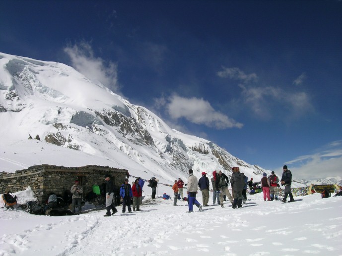
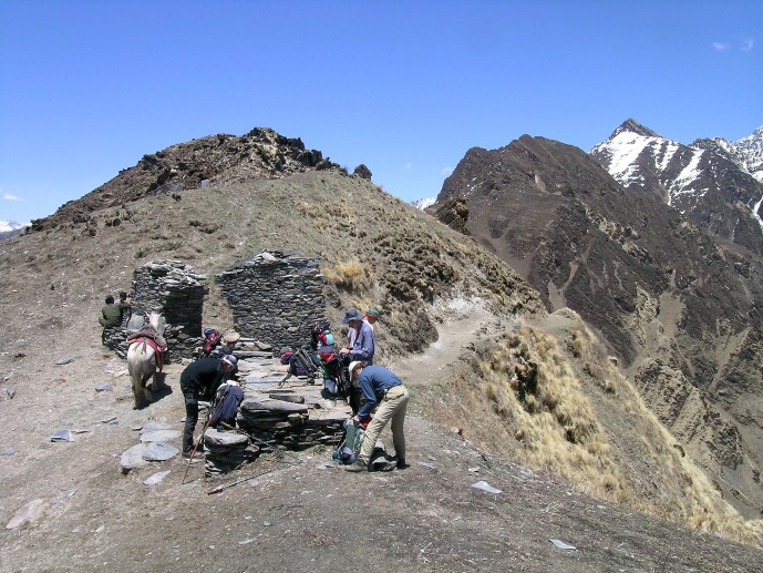
Day 08: Snowfields Camp (4400 m) to Shey Gompa (4310 m) via Kang La (5375 m) 6 hrs
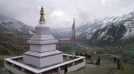
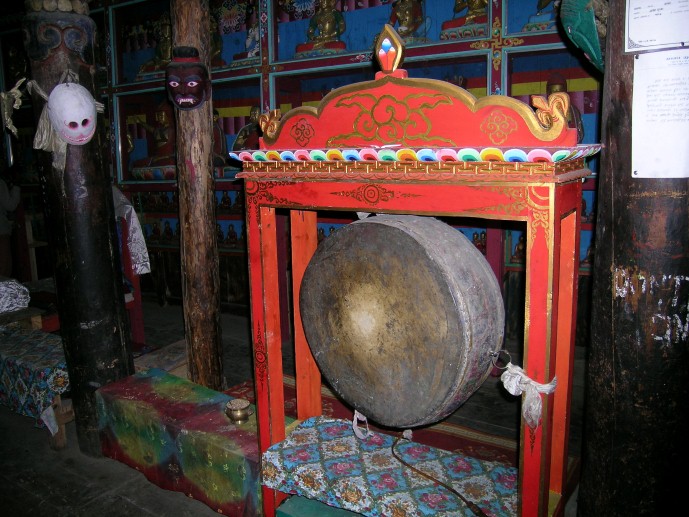
It’s a long and strenuous climb of about 2½ hours over a dusty path to Kang La (5350 m), locally also called Ngadra La. Prayer flags and cairns mark the pass. At the north side of the pass, there is snow most of the times, which makes the descend a bit difficult. The descend is pretty steep the first 45 minutes, but after this, it is going gradually for about 3 hours, till you reach Shey Gompa. Getting nearer, you pass red and white chortens and mani walls. Shey Gompa is a very small village, with a couple of houses, and of course the gompa (monastery). The 11th century gompa is located beneath the Crystal Peak on a small grassy plain, at the confluence of two rivers. It is said to be constructed by a Tibetan Buddhist, who arrived here on the back of a flying snowlion. It’s a magical place, and Shey Gompa is often called the spiritual heart of Dolpa. Every year hundreds of pilgrims come to visit the gompa and to make a kora (clockwise circuit) of the Crystal Peak. People living here are direct descendents of Tibetans, which you can notice easily by their faces and their dress. The women wear dark dresses with colorful aprons made from yak wool. Men wear a long coat, from which they let one sleeve hanging down.
Day 09: Restday Shey Gompa (4310 m)
During this day, you can go to Tsakang Gompa (4575 m), a monastery from the Buddhist Kagyupa sect. This gompa appears in the movie Himalaya as well. It is spectacularly located high on a red rocky slope. The trail to Tsakang Gompa partly follows the same trail as pilgrims follow to make a kora of the Crystal Peak.
You will probably see flocks of bluesheep in these areas. Many bluesheep live here, as the abbot of Shey gompa imposed a ban on hunting them. Besides, in these regions you have the best chance of seeing the snowleopard.
Day 10: Shey Gompa (4350 m) to Namgung (4430 m) via Shey La (5000 m) 6 hrs
Another pass to cross today, the Shey La, also called Gelu La, of 5000 m. The climb to the pass goes through a narrow valley. From the pass you have a good view to the north of the arid Tibetan Plateau, which is stretching out seemingly endlessly before you. To the east you can see Mustang. After the pass, it’s a long descend to the pastures of Namgung. Scattered in the landscape, you will see some fields, many times with a big Tibetan tent, as the fields are too far from the village to go there and go back each day. The people in Namgung are very friendly and open. A friendly Tashi Delek (Tibetan greeting) will always be welcomed with a big smile.
Day 11: Namgung (4400 m) to Saldang (4060 m) 3 hrs
It’s a short hiking day today. The path goes high above the Namgung Khola (River) and then descends steeply to the village of Saldang. Saldang is the largest settlement of Inner-Dolpo. It’s a spread out, traditional agricultural village, surrounded by fields. Barley, buckwheat and potatoes are among the few crops that can grow in this barren landscape. Besides, people live from what the yak gives them (cheese, meat, wool) and from trade. Saldang is close to the Tibetan border and some of the salt trade caravans pass through Saldang. The trading of salt for grain and rice is a century old tradition that still prevails in Inner-Dolpo. The people from Saldang are semi-nomadic. In the warm months they trek in the highlands with their herds of yaks and sheep. The ones who are better off let the pure nomadic people of Dolpa, the Drokpa, do this work. Sometimes you can see a camp of the Drokpa in these areas.
Day 12: Saldang (4060 m) to Sibu (4200 m) 5 hrs
It’s a fairly easy walk to Sibu, following the Namgung Khola southwards and passing little villages, like Namdo, along the way. The villages are surrounded by terraced fields of barley. The path goes alongside many mani walls, chortens and some gompa’s, which makes you realize how important Buddhism is for the people of Inner Dolpo. Buddhism is interwoven in each and every aspect of people’s life here.
Day 13: Sibu (4200 m) to Lagmo Che (4570 m) 4 hrs
The trail starts with an easy stretch, following the river. The last village you pass is Raka. After this, you enter a large, inhabited valley. Look out for bluesheep here. Besides, you may even come across a snowleopard… After 2 hours of trekking, the path turns away from the river and climbs steeply to a meadow of about 4570 m, which is often used by yaks to graze. This is Lagmo Che, the base camp for climbing to the Jeng La.
Day 14: Lagmo Che (4570 m) to Tokyu (4209 m) via Jeng La (5110 m) 7 hrs
It’s a steep climb of about 2 hours to reach the next pass: Jeng La at 5110 m. From the pass you have a spectacular view to the Dhaulagiri (8167 m) and many other snowcapped mountains. After the pass you descend into the Tarap Valley. You arrive at the village Tokyu (4209), a spread out village, which is the first human settlement after Raka. Tokyu is said to be the highest permanent settlement in the world. The gompa is worth a visit and has a beautiful statue of Maitreya, the Future Buddha.
Day 15: Tokyu (4209 m) to Dho Tarap (4080 m) 2 hrs
It’s not far to Dho Tarap. On the way, you pass the Cristal Mountain School, which is educating children from Dho and surroundings. It is sponsored by a French NGO. If you want, you can visit the school, the teachers are very pleased to show you around. From the school it’s about half an hour to Dho. At the entrance you pass a beautiful gate chorten. Also the people of Dho are direct descendents of Tibetans. Besides the typical dark dresses with colorful aprons, most Dho women wear bracelets of big shells and some have beautiful silver and turquoise headgear. Most men have long hair, with a red ribbon in their hair, in the style of Tibetan Khampas. Besides they wear the long coat, from which one sleeve is hanging down. The people in Dho are very friendly and it is easy to make contact. With the Cristal Mountain School so close by, especially younger ones do speak a bit English.
Dho Tarap is a traditional agricultural village, surrounded by fields. Yaks are used to plough the land. As in the other villages you came across, barley, buckwheat and potatoes are among the few crops that can grow here. But nowadays, small greenhouses enable the people to grow some green vegetables as well. Besides, people live from what the yak gives them and from trade. The houses are made of stones found in the river valley and are in typical Tibetan style, with small windows and the flat roofs stocked with firewood.
Close to Dho are 2 monasteries which are worth a visit. Ribo Bhumpa Gompa, right on the hill behind Dho, and Shipchaur Gompa which is in the village Shipchok, 30 minutes walking from Dho.
Ribo Bhumpa Gompa belongs to Nyingmapa Buddhism, by the local people called Chöba Buddhism. Inside you find a beautiful big statue of Guru Rinpoche. Guru Rinpoche (Padmasambhava) is a very important Buddhist saint from the 7th century AD. He conquered the demons who were preventing Buddhism to get hold in Tibet and in this way made sure that Buddhism could be introduced in Tibet. You can easily recognize him, by his big eyes, little mustache and the staff with skulls he holds. Next to the gompa is a chorten with another chorten inside, which is said to hold the remains of a demon killed by Guru Rinpoche.
Shipchaur Gompa in Shipchok belongs to Bonpo Buddhism. It’s an interesting gompa to visit, as you don’t see many Bonpo gompa’s. Unfortunately Shipchaur Gompa is in a rather bad shape, and in need of restoration. Dho has a big campsite close to the river, and some guesthouses (one with a campsite) where you can stay as well, among which: Angad’s Gallery and Café where you can find beautiful pictures from daily life in Dho, Caravan Hotel-Valley View Campsite and one without a name, but with a sign “hotel & shop”.
Day 16: Dho Tarap (4080 m) to Sisaul (3750 m) 4 hrs
A short day today again, so you have all the time to explore Dho in the morning.
Leaving Dho Tarap, you come along many mani walls and small chortens. The path is going down, following the Tarap Khola. Gradually you can see the landscape changing. Some bushes are appearing, it’s getting a bit greener. Just before arriving at Sisaul, you have to climb to a small pass. After the pass, the valley gets narrow. It’s a short descend to Sisaul, which has a good campsite next to a tent-hotel. You can choose to camp here, or on one of the spots a bit further down.
Day 17: Sisaul (3750 m) to Laina Odar (3370 m) 7-8 hrs
Soon after leaving Sisaul, you climb to a small pass with a nice chorten. After the pass you will see the first trees again. You mostly walk in the river valley with high rocks towering above you on both sides. The landscape is still pretty barren and this is your last change to see the bluesheep or snowleopard…
It’s a fairly easy walk of about 3 to 3½ hours from Sisaul to Nawarpani. The path gradually goes down. At some parts the path is beautifully carved out of the rock, so that you find yourself walking in a kind of three sided tunnel.
After Nawarpani, the landscape gets quickly greener and the path is sometimes going through pine forests, with a wonderful smell. It’s a fairly easy walk over a pretty large path, which sometimes goes very high above the river. You reach Laina Odar where there is tent-hotel, located at the riverside. This is a good place to camp.
Day 18: Laina Odar (3370 m) to Lingdo (2391 m) 5 hrs
From Laina Odar the trail goes down pretty steep to Laisicap (2772 m). The path goes partly through forests and you are surrounded by steep cliffs full of pine trees, mostly spruce, fir, juniper and cypress, some of which are huge. Sometimes the river is far below you. The walk to Laisicap takes about 3 hours. At Laisicap you cross Thuli Bheri river over a large suspension bridge of 120 meter, high above the river.
The trail goes down pretty steep for about 45 minutes. After this, it’s a fairly easy walk, gradually going down, with some flat parts as well. The landscape is impressive and sometimes very green. The sharp rocks are dotted with junipers and other pine trees. If you are lucky, you can see groups of large grey monkeys here. Behind you, you can see the beautiful snowcapped Kang Tokal (6294 m).
Getting closer to Lingdo, you can see some other villages in the distance, like Sarakot, which is situated high on a cliff. These are the first villages you see after Dho Tarap. You pass some Mani walls and chortens. Lingdo is a small village with one guesthouse with a campingsite. The people who live in this region are Tarali’s, a Magar group (who are Buddhist as well).
Day 19: Lingdo (2391 m) to Dunai (2140 m) 5 hrs
It’s an easy walk today. The first part goes through rough landscape. The path is sometimes carved out of the rocks, and at a few points very narrow. There are plans to make a motor able road all the way to Dho Tarap. Walking here, it seems that this is a huge challenge, and it surely will take a couple of years. But, may be a reason not to wait too long if you want to visit Dolpa…
After about 2 ½ hours your reach the small village of Byasgar (2427 m). After Byasgar, the landscape gets greener and sometimes reminds to the European Alps. Rocky slopes are dotted with pine trees, mostly blue pine. At the horizon you see the snowcapped Kang Tokal (6294 m). The path goes slightly up and down, following the Thuli Bheri River, once and a while passing a couple of houses.
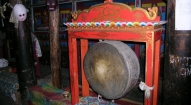
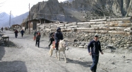
Dunai is the headquarters of Dolpa District. It’s a large village, of about 2.500 people, more or less half Hindu and half Buddhist. Up the hill, there is a Buddhist monastery, the Dolpa Kendriya Gompa, which is worth a visit. It is situated at the slope at the other site of the river, overlooking Dunai. The monastery belongs to the Nyingmapa lineage, the oldest Buddhism linege and was built in 1998. There is only one monk/lama. If he is there, he will be happy to open the monastery for you and show you around. Inside the gompa you can observe a beautiful statue of Sakyamuni Buddha (Gautama Buddha), the Kengyur (the holy scriptures of Buddhism) and big thankas (Buddhist paintings on cotton). There is a small daily puja (prayer ceremony) from 6-7 am and from 6-7 pm.
A bit further away from Dunai, at the same slope, you can find the Dolpo Bon School and Hostel. Besides the normal teachings that children receive at common schools, the Bon School educates children in the Bonpo religion, Tibetan culture and Tibetan language. The school offers education to poor and orphaned children in the district from Bonpo background. As the children come from different, far away villages, there is a hostal as well. Currently there are 26 children in the school, divided into 5 different classes. Unfortunately at present the school faces a lack of funds, due to which the children receive classes in a big tent. They are hoping for new funds to build a descent school building.
At regular schools, Tibetan language is not given, nor Tibetan culture and Bon religion. The school therefore helps to maintain a millennium old culture. The school and hostal make a very interesting visit which gives you a chance to learn more about Bonpo. One of the teachers will be happy to show you around and give you explanations about the Bonpo religion and culture. Besides the Hostal, there is a beautiful stupa with holds a century old footprint of an important lama. A Bonpo gompa is being built here as well.
In Dunai there is a guesthouse with a campsite: The Bluesheep Inn. Besides there are a few hotels, like Hotel Ghorka Palace and Lodge and Pala Guesthouse.
Day 20: Dunai (2140 m) to Juphal (2475 m) 3½ hrs
It’s a short walk to Juphal. After about 45 minutes you reach a beautiful gate chorten (stupa), which is the entrance to the VDC (Village Development Committee) Dunai. Inside the chorten you can observe some beautiful Buddhist paintings of mandala’s and important Buddhist figures.
You pass the big iron suspension bridge, which you crossed on the first day to get into the Shey Phoksundo National Park. From the bridge, it’s about 2½ – 3 hours to Juphal. The first part goes over a large path, passing through the small village of Kalagaonda. Then you leave the main road and walk over a small path, through fields of barley and wheat, with walnut, peach and apricot trees. It’s a pretty steep climb to reach Juphal. Just before arriving, you pass the Hindu village Dangiwada. Juphal is a large village with a small bazaar where it is nice to spend some time looking around.
In Juphal there is a guesthouse with a campsite: Hotel Mt Putha. Besides, there is a small guesthouse, Hotel Jharana
Day 21: Flight Juphal-Nepalgunj-Kathmandu
Early in the morning you fly to Nepalgunj. Especially the first part of the flight through the mountain valleys is spectacular. Later in the day, you fly back to Kathmandu.